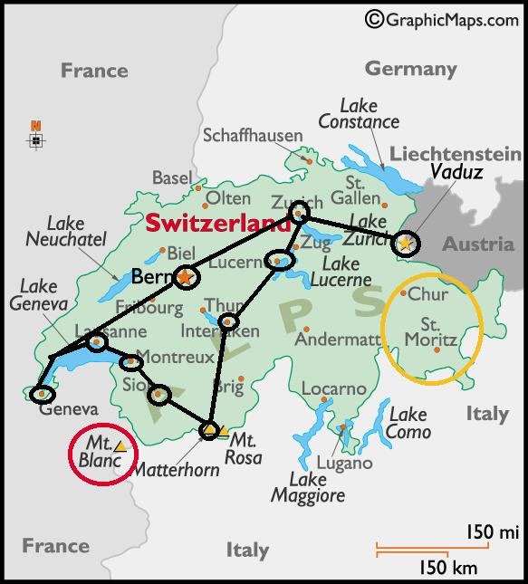
At the heart of Europe
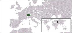
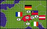
It is often said that Switzerland lies at the heart of Europe. Geographically speaking, that's not quite true. However, the main route linking northern and southern Europe does run through the Alps. Switzerland borders Germany in the north, Austria and the Principality of Liechtenstein in the east, Italy in the south and France in the west. This means that three important European cultures meet in Switzerland - that of the German-speaking region, the French and the Italian.
The geography of Switzerland is notable for its great diversity.
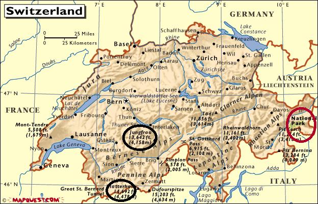
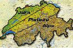
Switzerland’s three main geographical regions are the Jura, Plateau and the Alps.
Beneath you have location of Switzerland in the centre of Europe and its neighbours:
Size, regions, population
Switzerland has an area of 41,285 square kilometres (15,940 square miles).
The Jura, the Plateau and the Alps form the three main geographic regions of the country. You have them marked on the map beneath:
7.3 million people- just over one thousandth (0.1 per cent) of the global population - live in Switzerland. Switzerland has a high population density, with 237 people per square km (614 per square mile) of the productive area. In the agglomerations, which cover about 20% of the total surface area, the density is 590 per square km (1528 per square mile).
Switzerland is densely populated, with an average of 183 people per square kilometer.
However, there are major differences between the geographical regions. The geography of Switzerland means that the climate varies greatly from one region to another. Depending on the area and the time of year, Switzerland experiences conditions reminiscent both of Siberia and of the Mediterranean.
The Plateau
The Plateau stretches from Lake Geneva in the south west to Lake Constance in the north east, with an average altitude of 580 m (1902 ft).It covers about 30 percent of the country`s surface area, but is home to two thirds of the population. There are 450 people to every square kilometre (1,166 per square mile). Few regions in Europe are more densely populated.Most of Switzerland's industry and farmland is concentrated in the Plateau.
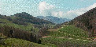
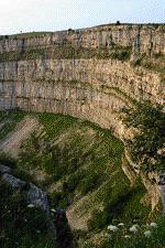
The Jura
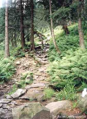
The Jura, a limestone range stretching from Lake Geneva to the Rhine, makes up about 12 per cent of Switzerland’s surface area. Located on average 700 meters (2,300 feet) above sea level, it is a picturesque highland crossed by river valleys.Numerous fossils and dinosaur tracks have been found in the Jura region, which has given its name to the Jurassic period. The rocks of the Jura were formed between 208 million and 144 million years ago. Jurassic period rocks are found in numerous places in the world, but it was in the Jura that they were first studied, at the end of the 18th century.

Typical Jura landscape near Langenbruck, Canton Basel-Country
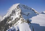
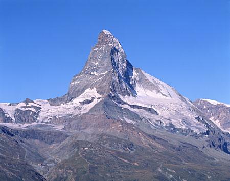
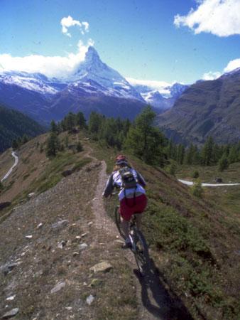
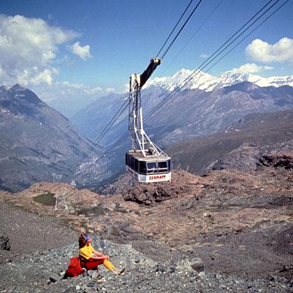
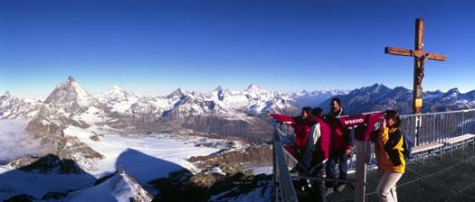
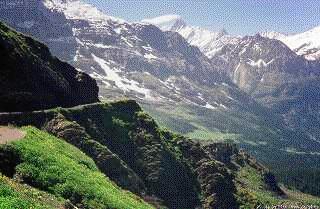
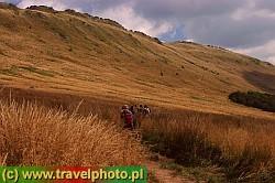
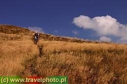
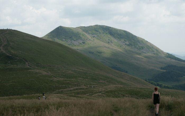
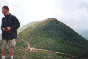
The Alps
The Alps span some 200 kilometres (125 miles), at an average altitude of 1700 m (5576 ft), and cover nearly two thirds of Switzerland's total surface area. They provide a continental watershed, determining the climate and vegetation, But while they contribute enormously to the Swiss identity, economic activity is concentrated in the Plateau.The valleys of several major rivers - the Rhone, Upper Rhine, Reuss and Ticino - divide the mountain ranges.
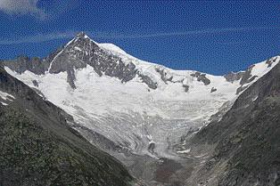
 The Aletschhorn and the Aletsch glacier, Canton Valais

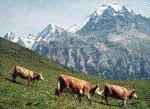
Cows in the Bernese Oberland. In the background the Eiger, Mönch and Jungfrau
The average height of the mountains of the Swiss Alps is 1,700 meters (5,576 feet). The snow line begins at 2,500 meters (8,200 feet). There are 48 mountains which are 4,000 meters (13,120 feet) or higher and about 1,800 glaciers.The best known mountains are the Alps, but Switzerland has a second range, the Jura.
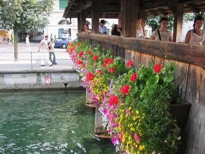
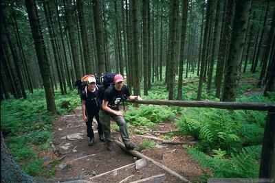
In a country whose people pride themselves on keeping everything pretty and neat, the mountains, with their cracks and crevasses, their sheer faces and often unpredictable weather could not offer a more daunting contrast. Down below, everything is small and on a human scale. But look up, and the immense size of the mountains is overwhelming.In a hectic, ever-changing society, the mountains are a constant. To enter the mountains means to enter another time zone, another world, leaving everyday life behind. They give a new perspective, both literally and figuratively.

People's attitudes towards the mountains have changed over the centuries. In mediaeval times they were seen as the home of malevolent spirits. Scientists started to take an interest in them in the 18th century, and shortly afterwards writers and artists fired by the ideas of the Age of Romanticism began to extol their beauty. As the 19th century progressed, more and more people, especially foreigners, came to regard them as a challenge and set themselves the tasks of conquering the hitherto virgin peaks. By the end of the century, practically every peak had been climbed.
Language distribution
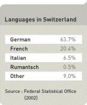
German
German is by far the most widely spoken language in Switzerland: 17 of the 26 cantons are monolingual in German.
French
French is spoken in the western part of the country, the "Suisse Romande." Four cantons are French-speaking: Geneva, Jura, Neuchâtel and Vaud. Three cantons are bilingual: in Bern, Fribourg and Valais both French and German are spoken.
Italian
Italian is spoken in Ticino and 4 southern valleys of Grisons.
Rhaeto-Rumantsch (Rumantsch)
Rumantsch is spoken only in the trilingual canton of Graubünden. The other two languages spoken there are German and Italian. Rumantsch, like Italian and French, is a language with Latin roots. It is spoken by just 0.5% of the total Swiss population.
The many foreigners resident in Switzerland have brought with them their own languages, which taken as a whole now outnumber both Rumantsch and Italian. The 2000 census showed that speakers of Serbian/Croatian were the largest foreign language group, with 1.4% of the population. English was the main language for 1%.
Language rights
Language rights are enshrined in the Swiss constitution. German, French, Italian and Rhaeto-Rumantsch all have the status of national languages, but only the first three are official languages. Nevertheless, Rumantsch is used in official communications with Rumantsch speakers, who in turn have the right to use their native language in addressing the central authorities.The constitution also contains provisions to enable the federal authorities to help Ticino and Graubünden support Italian and Rumantsch respectively.Foreigners often assume that the fact that there are four national languages in Switzerland means that every Swiss speaks four languages, or at least three. However, the reality is very different.
Linguistic profiency and English
The Swiss can certainly be proud of their linguistic proficiency and many understand the other languages of their fellow countrymen very well. However, proficiency in the national languages is decreasing in favour of English. Quadrilingual Switzerland is apparently becoming a two-and-a-half-language Switzerland. Many people speak their mother tongue and English and understand a second national language.
Each canton makes its own decision about which language will be taught when. In German-speaking Switzerland children have traditionally started French from the age of 9, while French speakers have started German at the same age. In Ticino and the Rumantsch-speaking areas, both French and German are learned during compulsory schooling. Ticino decided in 2002 to make English a compulsory subject, alongside French and German. To lighten the load, children will be able to drop French when they start English in the 8th year.Zürich's education minister provoked a national debate in 2000 by announcing that his canton intended to make English the first foreign language, rather than French. Supporters of the move point out that English is more useful in the world. They add that children and parents are in favour and that since motivation is an important ingredient in language learning, pupils are likely to learn English more successfully than they do French.Opponents see the decision as a threat to the unity of Switzerland, and fear that French and Italian speakers will be put at a disadvantage because they will still need a good standard of German to rise in their careers within Switzerland.
Swiss history (VERSION I)
Switzerland's history cannot be understood without considering its geography, which has had a considerable impact on determining the development of its way of life.The country that we know today took its final shape only in 1848. Before that time, we cannot really speak of "Swiss history," but rather the history of its various parts, which only gradually came together.
Prehistoric times
The oldest traces of human existence in Switzerland date back about 150,000 years, and the oldest flint tool found in the country is thought to be about 100,000 years old.The best known early prehistoric site is at Cotencher in Canton Neuchâtel, where Neandertal hunters left flint cutting tools in a cave some 60,000 years ago.Farming reached central Europe from the Mediterranean area in the 6th millennium BC. The oldest known farming settlements in Switzerland are those found at Gächlingen in Canton Schaffhausen, which have been dated to around 5300 BC.Metal - in the form of copper - was first made in Switzerland around 3800 BC, and bronze - a much harder and stronger alloy of copper and tin - some 1500 years later. The iron age began in Switzerland around 800 BC.Although copper ore was found locally, tin had to be imported - an indication that trade was already highly developed.The so-called "Amesbury Archer", or "King of Stonehenge", buried in southern Britain around 2300 BC, and discovered in 2002, probably came from what is now Switzerland.
Middle Ages
The period following Roman rule, generally known as the Dark Ages or Early Middle Ages, lasted from about 400 to 1000.The territory of what is now Switzerland shared a similar evolution with the rest of western Europe.The first couple of centuries or so was a time of migration, moving in the general direction of east to west. Peoples were displaced as waves of new tribes arrived from Asia.Switzerland was settled by different peoples, who brought not only new lifestyles, but also new languages.Christianity which had arrived in Switzerland under the Romans, took root and spread, partly through the work of missionaries. The church, with its system of bishoprics and monasteries, became a major landowner with rights over all those who lived on its lands. At the same time, noble families were increasing their power and building up their landholdings by conquest, inheritance and marriage.For a brief period the Frankish king Charlemagne controlled much of Western Europe and took the title Emperor of the West in 800. However, even under Charlemagne there was no idea of a state. At every level of society, relations between weak and strong were based on personal allegiance. The emperor ruled through a network of noble families.Throughout the period, and beyond, the balance of power between kings, dukes and the church constantly shifted as each jockeyed to preserve its old privileges or to grab new ones.A further level of power was added in 962 when the German king Otto I persuaded the Pope to crown him Emperor of what much later became known as the Holy Roman Empire.
The year 1291 is traditionally regarded as the foundation of the Swiss Confederation, when three rural communities made an alliance to protect their freedoms against encroachments by would-be overlords.The 14th and 15th centuries saw this group expand to a loose confederation with both rural and urban members. By the end of the period the Confederation was strong enough to have a serious impact on the balance of power in Europe in wars where their troops gained a fearsome reputation for their skill and courage.Expansion proceeded in several ways. In some cases new members joined the Confederation as equals; other communities or territories came by purchase or conquest.The rights of the inhabitants of the Confederation still depended both on the place where they lived and on their position in society.The Confederate members administered their own affairs, but also held frequent diets to discuss issues of common interest. In this period Zurich, Bern and Lucerne took it in turns to summon the meeting. Each member sent one or two representatives, drawn from the political leadership.
The Reformation
The 16th century was a time of upheaval throughout western Europe, when a movement to reform the Roman Catholic church split western Christendom into two opposing camps, as Protestants rejected the authority of the Pope.Although the movement was ostensibly a religious one, it reflected deep underlying tensions in the social structure. In Switzerland, as elsewhere, it was accompanied by riots and destruction. Supporters of the reform all over Europe smashed the "idolatrous" statues and pictures in churches, and threw monks and nuns out of their monasteries, in many cases never to return.But discontent went beyond obvious manifestation of discontent with the church to attack the very structure of society. "Extremist" Protestant movements like the Anabaptists, which found their followers in the rural regions and which among other things called for an end to tithes and rents, were forcibly repressed by mainstream Protestant leaders.Theological debate gave rise to a debate about tolerance; Geneva adopted an authoritarian stance, imprisoning, expelling or even burning those Protestants who disagreed with the official line, while Basel became a centre of intellectual freedom.
The XVIIth century
The 17th century saw three further landmarks in the development of modern-day Switzerland. All came as a result of the 30 Years War (1618-48), which ravaged large swathes of Europe, particularly Germany, but in which the Confederation succeeded in remaining neutral.Firstly, the war made it clear to the Confederation members that despite their deep differences, it was in their interest to stay together as the only way to avoid being drawn into a Europe-wide conflict.Secondly, they gradually formalised the important policy of armed neutrality, to prevent border incursions by the warring armies.Thirdly, Swiss independence from the Holy Roman Empire was formally recognised by signatories of the Treaty of Westphalia, which ended the war.Despite this, Switzerland was not a haven of peace. Both social and religious tensions sparked armed conflict within the country in the second half of the century.
The XVIIIth century
The 18th century was a period of relative peace and prosperity, until its last decade when French revolutionary troops invaded and destroyed the old political system.During the 18th century, great advances were made in scientific agriculture. New industries got off the ground, including clockmaking and textiles.Learned and patriotic societies sprang up all over the country. Swiss intellectuals discussed new scientific and philosophical ideas with their counteparts abroad. At the same time, they promoted Swiss national awareness, going beyond narrow cantonal boundaries.The new industrial and intellectual elite challenged the entrenched ruling circles.The century ended in Europe-wide turmoil after the French revolution and France's subsequent wars against European monarchies.French troops invaded Switzerland in 1798, broke the power of the ruling élites there and temporarily destroyed the cantonal system by creating the centralised Helvetic Republic.For the first and only time in their history the Swiss were forced to abandon their neutrality and provide troops for France.
The federal state
The foundations of modern Switzerland were laid down in the 19th century. The most important event was undoubtedly the adoption of the 1848 constitution, which gave the country a more centralised government and created a single economic area where cantonal rivalries had previously hindered development.Among other things the new goverment abolished internal tolls, it unified weights, measures and the currency and it took charge of the postal system.These moves made possible the development of many of the industries and services which are still the cornerstone of Switzerland's prosperity, such as chemicals, engineering, the food industry and banking.However, for many people conditions continued to be very difficult. Poverty, hunger and lack of employment prospects encouraged large-scale emigration throughout the 19th century, much of it to north and south America.
The XXth century
The 20th century saw important changes in Switzerland in both domestic and foreign policy.The political system opened up. At the beginning of the century a single party dominated the government; by the end of it four parties had guaranteed ministerial posts.The economy ran into difficulties in the 1920s and 30s, but overall Switzerland prospered. The move away from agriculture and into highly skilled specialist industries continued. From being a country of emigration, in the second half of the century it became a country which drew immigrants.The standard of living increased dramatically for most people. They gained far better social security and working conditions, as well as access to an extensive range of consumer goods.The century also saw a sharp shift in Switzerland's relations with Europe and the rest of the world.For most of the period Switzerland continued outside the European mainstream. It took no active part in either of the two World Wars. However it later found it harder and harder to remain a "special case" in the face of globalisation and European integration. The issue of Swiss neutrality remained a central topic of debate.At the end of the century, Switzerland reexamined its role in World War II. The Bergier commission of expert historians investigated criticism of Switzerland's wartime behaviour and produced its final report in 2002. The Bergier report has been a key element in leading the public to re-evaluate a period of history which had previously been largely ignored. Its thorough investigation threw light on both positive and negative aspects of Swiss behaviour.
SWISS HISTORY (VERSION II)
Switzerland is a federation of relatively autonomous cantons, some of which have a history of confederacy that goes back more than 700 years, arguably putting them among the world's oldest surviving republics.
According to the popular legend, in 1291, representatives of the three forest cantons of Uri, Schwyz, and Unterwalden signed the Federal Charter. The charter united the involved parties in the struggle against foreign rule by the Habsburgs, who then held the German imperial throne of the Holy Roman Empire. At the Battle of Morgarten in 1315, the Swiss defeated the Habsburg army and secured quasi-independence as the Swiss Confederation. The authenticity of the Federal Charter is disputed with many historians agreeing that it is in fact a forgery of the 14th century.
By 1353, the three original cantons had been joined by the cantons of Glarus and Zug and the city states of Lucerne, Zürich and Berne, forming the "Old Federation" of eight states that persisted during much of the 15th century (although Zürich was expelled from the confederation during the 1440s due to a territorial conflict) and led to a significant increase of power and wealth of the federation, in particular due to the victories over Charles the Bold of Burgundy during the 1470s, and the success of the Swiss mercenaries. The traditional listing order of the cantons of Switzerland reflects this state, listing the eight "Old Cantons" first, with the city states preceding the founding cantons, followed by cantons that joined the federation after 1481, in historical order. The Swiss victory in a war against the Swabian League in 1499 amounted to de facto independence from the Holy Roman Empire.
In 1506, Pope Julius II engaged the Swiss Guard that continues to serve the Vatican to the present day. The expansion of the federation, and the reputation of invincibility acquired during the earlier wars, suffered a first setback in 1515 with the Swiss defeat in the Battle of Marignano.
The success of Zwingli's Reformation in some cantons led to inter-cantonal wars in 1529 and 1531 (Kappeler Kriege). The conflict between Catholic and Protestant cantons persisted, erupting in further violence at the battles of Villmergen in 1656 and 1712.
Under the Treaty of Westphalia in 1648, European countries recognised Switzerland's independence from the Holy Roman Empire and its neutrality (ancien régime). In 1798, armies of the French Revolution conquered Switzerland and in 1803, Napoleon Bonaparte imposed a new constitution, largely restoring Swiss autonomy. The Congress of Vienna in 1815 fully re-established Swiss independence and the European powers agreed to permanently recognise the Swiss neutrality. At this time, the territory of Switzerland was increased for the last time, by the new cantons of Valais, Neuchatel and Geneva.
In 1847, a civil war broke out between the Catholic and the Protestant cantons (Sonderbundskrieg). Its immediate cause was a 'special treaty' (Sonderbund) of the Catholic cantons. The war lasted for less than a month, causing fewer than 100 casualties. Apart from small riots, this was the latest armed conflict on Swiss territory.
As a consequence of the civil war, Switzerland adopted a federal constitution in 1848, amending it extensively in 1874 and establishing federal responsibility for defence, trade, and legal matters. In 1891, the constitution was revised with unusually strong elements of direct democracy, which remains unique even today. Since then, continued political, economic, and social improvement has characterised Swiss history.
In 1920, Switzerland joined the League of Nations and in 1963 the Council of Europe.
Switzerland proclaimed neutrality in World War I and was not involved militarily in the conflict. Neutrality was again proclaimed in World War II, and although a German intervention was both planned and anticipated, it ultimately didn't occur. The massive mobilization of Swiss armed forces under the leadership of General Henri Guisan is often cited as a decisive factor that the German invasion was never initiated. Modern historical findings, such as the research done by the Bergier commission, indicate that another major factor was the continued trade by Swiss banks with Nazi Germany.
Women were granted the right to vote in the first cantons in 1959, at the federal level in 1971, in the last canton only in 1990. In 1979, parts of the canton of Berne attained independence, forming the new canton of Jura. On April 18, 1999 the Swiss population and the cantons voted in favour of a completely revised federal constitution.
In 2002 Switzerland became a full member of the United Nations, leaving the Vatican as the last widely recognized state without full UN membership. Switzerland is not a member state of the EU but applied for membership therein in May 1992. Switzerland has not advanced this application since the rejection, by referendum, of the European Economic Area in December 1992. However, Swiss law is gradually being adjusted to that of the EU and the government has signed a number of bilateral agreements with the European Union. Switzerland (together with Liechtenstein) has been surrounded by the EU since Austria's membership in 1995. On June 5, 2005, Swiss voters agreed, by a 55% majority, to join the Schengen treaty, a result that was welcomed by EU commentators as a sign of goodwill by a Switzerland that is traditionally perceived as isolationist.
Trains
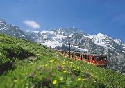
December 2004 marked a new stage in the development of Switzerland’s rail network, when the Swiss Federal Railways - SBB - inaugurated what it proudly describes as a public transport network for the third millennium to meet the challenge of the ever growing demand for mobility.The Rail 2000 project, as it is called, uses the latest technology and has required the construction of new lines. It aroused great public interest. The SBB arranged various “open days” and information centres to keep customers up to date with progress. When the new timetable was put on the internet in April 2004 to give users a preview of the services on offer in December, the site was overwhelmed.Rail 2000 is simply one part of Switzerland’s ongoing efforts to maintain an excellent transport system that meets current needs.Other projects involve the construction of the longest, deepest rail tunnels yet and the promotion of new railway technology, to ensure that the country remains an important transit route for goods and people as it has been for millennia.In a determined effort to preserve the environment, Swiss transport policy is to encourage the use of rail rather than road, particularly for freight, improving the rail service and charging trucks for using the roads.Since the railways first developed in the 19th century, they have helped shape Switzerland. They are shaping the Switzerland of tomorrow as well.
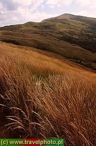
At last another nice picture from Swiss Alps and it will be continued soon (specially the part about about mountains trains)